Chapter III – Practical studies
The new network: 159–160
We are confident we have not exaggerated this, and that this is the scale of construction required in a town of 37,000 population, with a surrounding population of about the same size
The new network
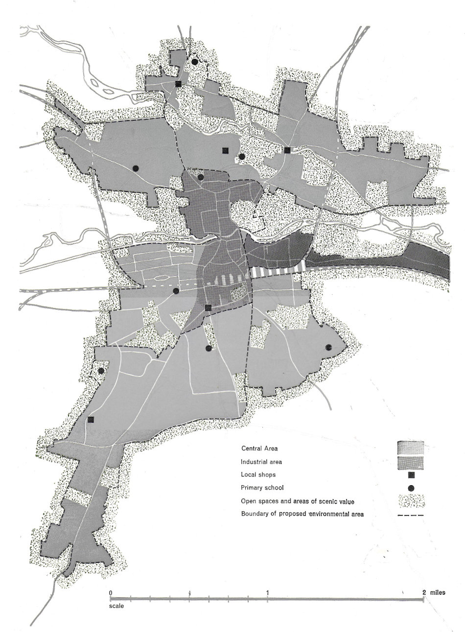
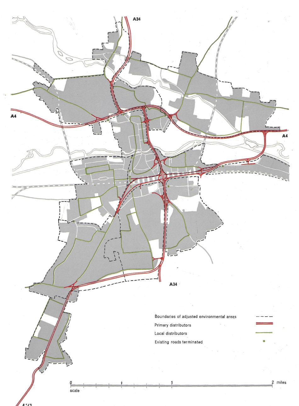
159We thus gradually built up a tentative pattern of environmental areas for the whole town (Figure 87), and then we amalgamated this with the provisional road network to produce the overall arrangement shown in Figure 88. The new roads of the network were not thought of as ‘relief roads’ for the town centre. They represent a more positive concept than that. They provide a new system for distributing traffic to the various parts of the town. They involve a considerable disciplining of movement. Drivers would, for example, find themselves with little choice of route, the layout of roads would prevent cross-filtration and short-cuts through residential areas. But to compensate for this there would be the facility of roads designed expressly for movement.
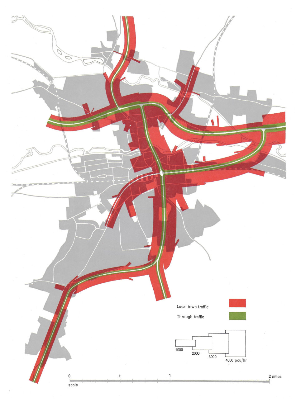
To enable the network to be designed in more detail, a peak hour flow diagram was then constructed for the new network. This is shown in Figure 89, and when compared with Figure 75 it gives a good idea of the very substantial nature of the traffic flows at the turn of the century. From this we were able to work out the widths of the new roads and the layout of the intersections (Figure 88). The really important point to note is that high standard roads are involved, with the need for at least one two-level intersection. We are confident we have not exaggerated this, and that this is the scale of construction required in a town of 37,000 population, with a surrounding population of about the same size, if full use of motor vehicles is to be made possible.